
I spotted Mesa Verde National Park on the map when searching for an interesting driving route to the Grand Canyon. This park advertised cliff dwellings of the Pueblo people that were created some 1,400 years ago and showed a picture of a mesa (I assumed green with vegetation) on their park symbol. Since I had not traveled in that area of Colorado, I immediately imagined a mirage of green in a vast desert near the four corners. But what we discovered was rich soil, culture, and a fascinating landscape with views to New Mexico.
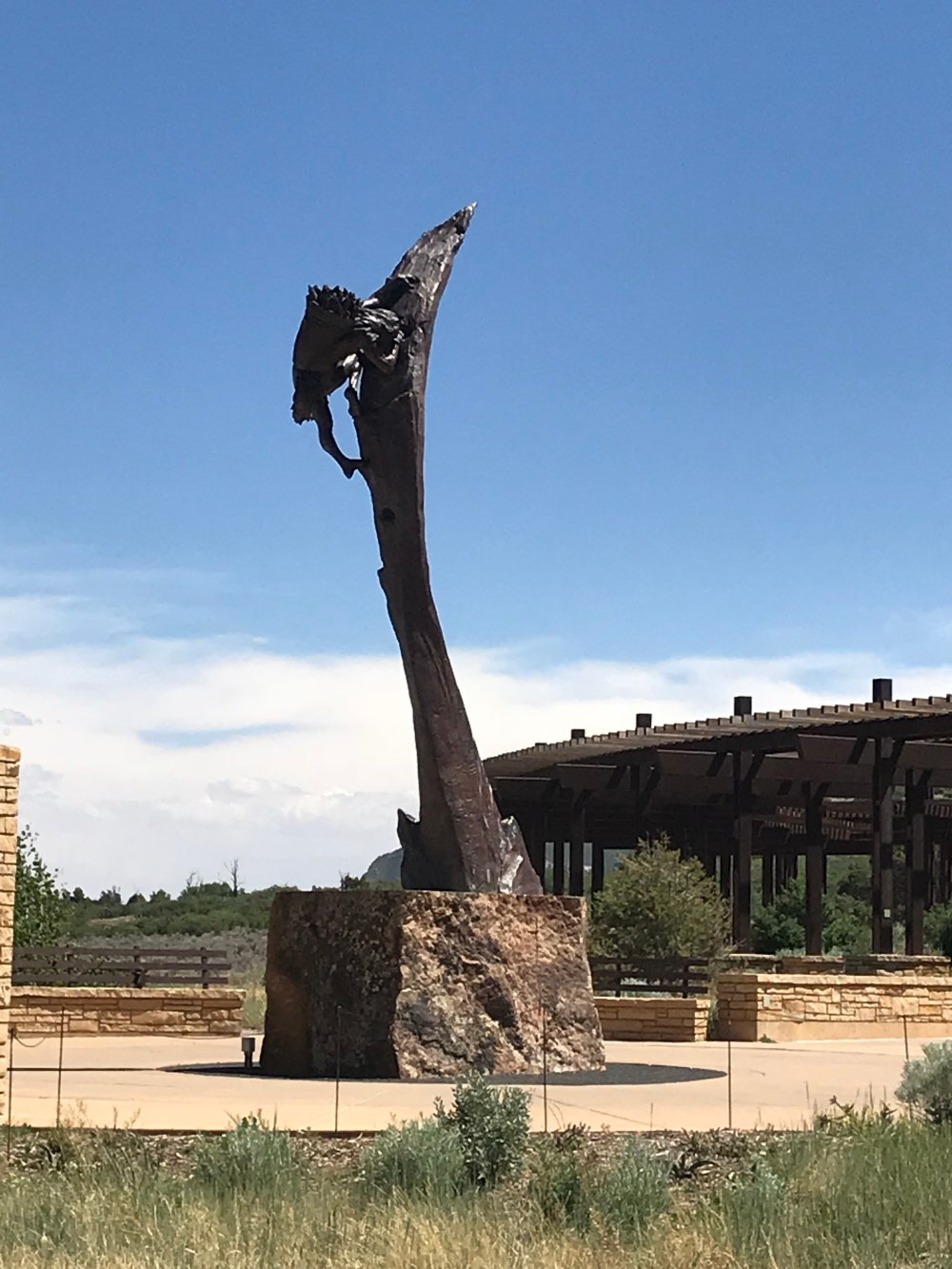
Driving to Mesa Verde from the East, we descended from twisting mountain passes and rocky waterfalls through small towns and finally into Durango. Outside of this bustling small city, we continued to flatter agricultural ground with views of the mountains. The varied landscape that included pines, juniper and scrub oak came to a collage of green as we arrived at Mesa Verde National Park. The park entrance sits in the valley, with the mesa towering perfectly behind the 2012 visitors center. Understated national park architecture of rock and stained wood was the ideal setting to begin our journey back in time. We stopped for photos and to admire the statue that towers before visitors at the entrance to this new center.
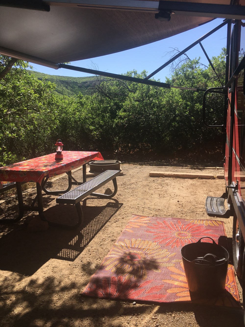
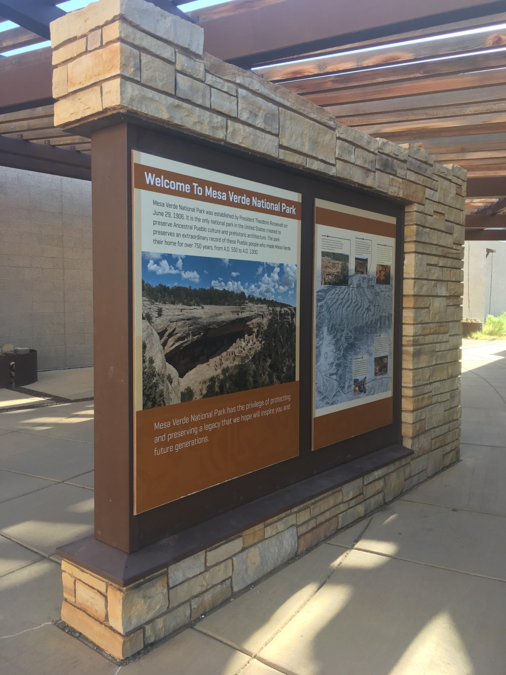
The park was created in 1906, making it one of the oldest national parks. President Roosevelt used the new Antiquities Act to create this park with the intent to maintain and restore the numerous ruins that dot the landscape. We got a map and a few books and headed out for the four mile drive to Morefield Campground. This drive was reminiscent of the Wolf Pass drive we had completed earlier with several tight corners and switchback leading to steep overlooks. The campground is situated four miles into the park and 16 miles from the center of the park where several of the dwellings are located. It has a gas station, camp store, showers, and laundry area. The entire campground is maintained by Aramark and is gently used and overgrown with vegetation. We had reserved a full hook-up site, but it is not possible to select a site number. It is assigned on arrival. I had read the reviews of various sites that I did not want; the full hook up sites without shade or privacy. I wanted a site with trees and, without asking, the woman at the front desk assigned us a thickly-treed site in Ute Loop which had three sides of scrub oak. We wound our way to our loop on a one-way, one-lane blacktop road with cement drainage ditches on both sides. Arriving at our site, we noticed it contained a campfire ring, table, and a lot of dirt. It was level, but it had probably been at least 10 years since any gravel had been added to the site. The powdery dirt that built the dwellings and kivas around us would now be coming home with us, clinging to our camp chairs and creating a filmy layer on our BBQ.
The sites are not huge, and some have better views or layouts than others. I was pleased with the trees and the inability to see any neighbors. More challenging, however, was that the site was at a perfect 90 degree angle from the road, with heavy scrub oak directly across from the entrance to the site. The Micro Minnie is 19 feet long and it was attached to a Ford Explorer, so maneuvering had not been an issue. But the uphill road, and the 90 degree back-in spot proved a reasonable challenge. Luckily, the other campers around us had just endured the same experience and offered their directional assistance for parking. We were hooked up and parked within 20 minutes of arrival and ready to explore.
After a quick dinner, we went back to the visitor’s center to learn about the history of the park. It is filled with artifacts recovered not only from the site, but also from the creation of the original visitor’s center during the 1930s. Hands-on computerized displays are mixed with life-size depictions of Puebloan life on the mesa. Several maps and tour books are available for purchase. We selected a book on the birds in the park and also a map and history of the Knife Edge Trail.
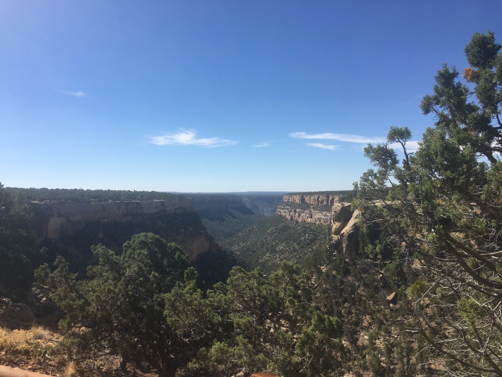
The visitors center closed at 7 p.m., so we headed to the Knife Edge Trail look-out, located further in the park. Passing through the narrow, non-lighted tunnel and emerging near the entrance to the trail, one immediately notices the signs marking various fires that have occurred within the park in the past 20 years. According to a park ranger, approximately 60 percent of the park has burned. This park is truly a story of rejuvenation and regrowth along with ancient cultures. We arrived at our evening destination, an amazing view of the sunset from the knife edge trail look-out. The fields and valley below were emerald and lush, not at all what I expected. We had gained elevation in our drive from the visitor’s center, and the view of the land below was our reward. We enjoyed a short walk as the trail was closed due to falling rock. I imagined the cars of 80 years ago attempting to cross this narrow path and the idea made me shudder.
We headed back to the campground and enjoyed a peaceful night. The campground was almost full and very quiet. At night, the sky is loaded with thousands of stars, visible since this park is “dark” and has little light pollution. I could easily see why the Puebloans settled here, on this mesa, with a perfect view of the stars to determine planting cycles, seasons and weather changes.
Day 2
We left early in the morning and made our way further into the park to the Far View Lodge. Again, the lodges are also managed by Aramark and offer full hotel-style stay options. I did not go inside the lodge, so I cannot comment on them. However, their views reach 60 miles to New Mexico and Shiprock. One could stand and observe this view all day and be perfectly satisfied, but we had things to see beginning at 8 a.m. We took the “700 years tour” which provides an air conditioned bus to various sites, a full tour of the famed Cliff Palace, and a tour guide who was immersed in the culture and loved the park. As a retired park ranger, she knew not only facts about the people who previously inhabited the area, but also the park’s history, its many current projects, and all the park rangers by name. She made Mesa Verde come to life for four hours of amazement.
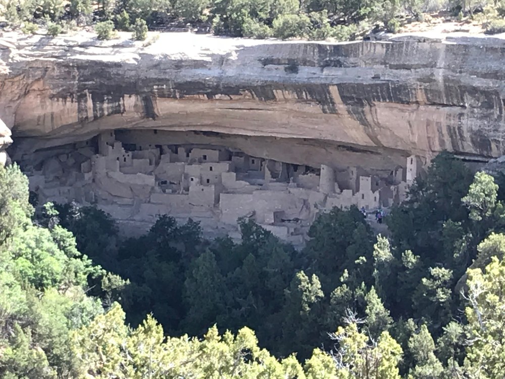
During the tour, we stopped at several sites. There are more than 500 dwelling sites in the park, so obviously we went to only a handful of them. We saw pit houses, kivas, sites from various look-out points that made us wonder how people created these homes, and finally the Cliff Palace; the site one sees on every ad for Mesa Verde. While the rangers and the park information is very clear about the requirements for getting into and out of Cliff Palace, one cannot truly appreciate this vast land until standing above the canyon 8i9i walls that house these dwellings. To get out of Cliff Palace, one must go up several stairs, some in sandstone, and then climb three, 10-foot ladders that are clinging to a cliff. Quickly I determined what we all know; today’s humans are not in the same physical shape that people were in 700 years ago. Living in this lovely setting still required water (found both in the sandstone and in the river far below the setting), food (grown on the mesa), and usual pottery and clothing. The abundance of cultural information and artifacts is astounding. We can walk in the footsteps and into the homes of people who lived 700 years ago and see what they saw. The tour was an excellent overview of this place and culture, but we also realized how much more there was to discover.
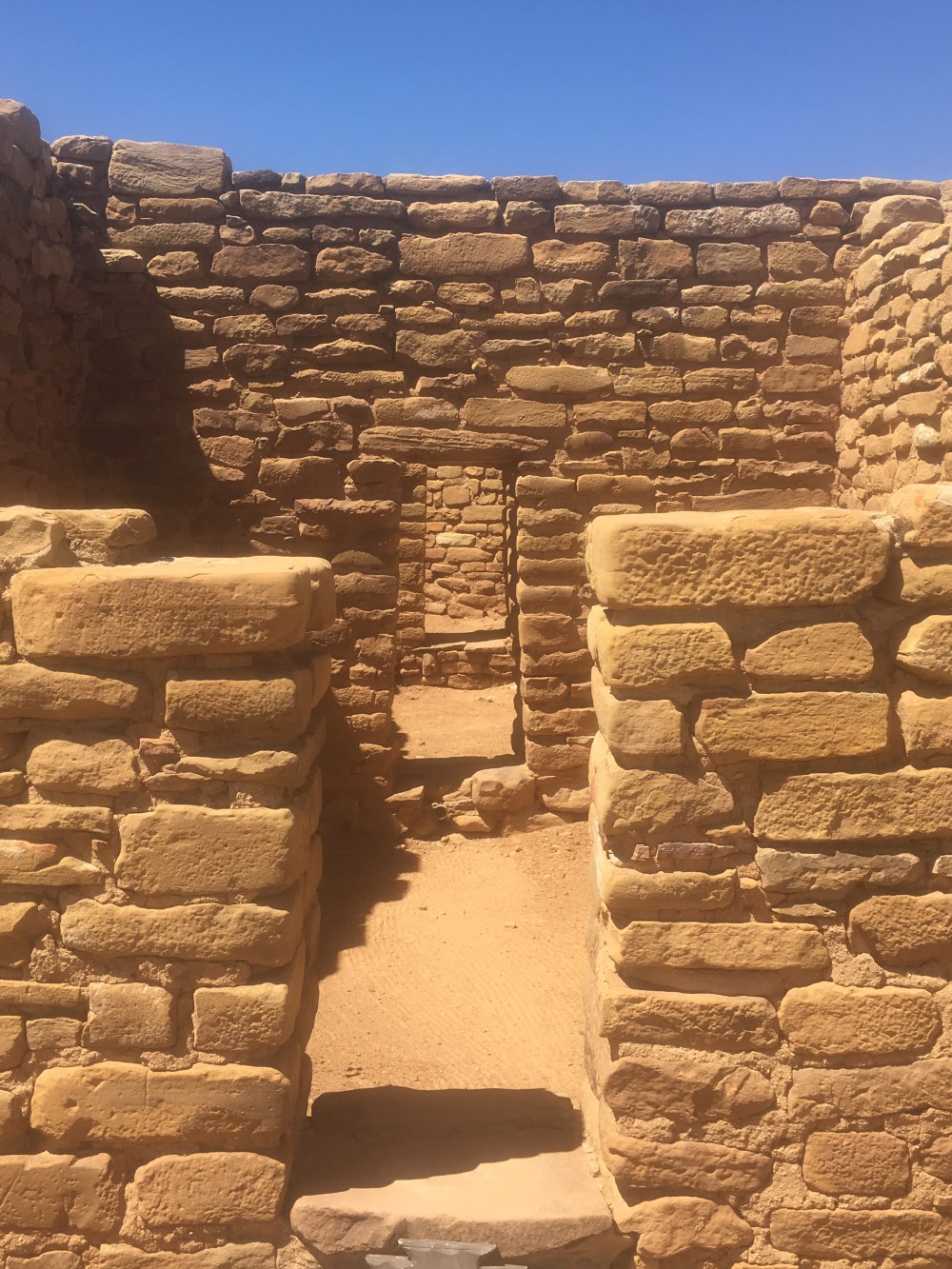
After the tour, we had lunch at one of the cafes on the property and then headed to the Chapin Mesa Museum. This building was constructed in the 1930s and contained many artifacts, a movie, several dioramas, and the Junior Ranger badge station (important for my son). After going through the building and watching the movie, we headed outside for a quick hike to Spruce Tree House, one of the four major sites and the only accessible without a ticket. Sadly, the site was closed due to a rock fall, but we hiked down the Spruce Canyon Trail. The full trail leads to petroglyphs and other fun finds, but we did not complete it as the weather was quite warm. We instead stopped at the Far View sites on our way back to the campground and walked around the remaining buildings of this small city that once housed several families. We were the only people at this large site.
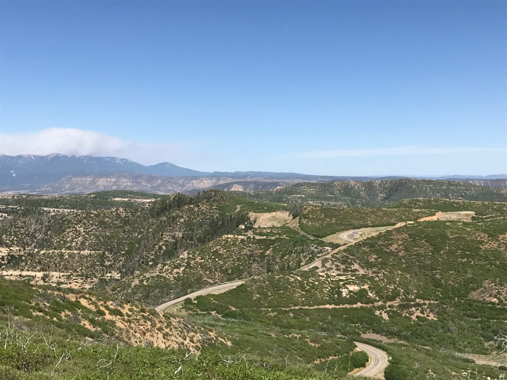
We then stopped at Park Point Overlook, the highest point in the park. From this open pinnacle, we found our best view of the surrounding land. This site required a short, uphill and exposed walk from the parking lot. By the time we drove yet again through the tunnel to return to our campsite, it felt as though we had traveled through a vast portal of history and there was so much more to learn about this area.
After being captivated by the stars the night before, we went to the daily 9 p.m. program in the amphitheater within walking distance of our campsite. The ranger gave a fun and introductory-level, family oriented talk about the night sky as the stars began to appear. His large PowerPoint presentation screen did not interfere with the stars as he constantly told us as each star or constellation as it emerged. A lovely, dark walk back to the site was the perfect ending to the adventure-filled day.
